Fancy Charts: A Time Table (Created: 1864)
Art, Charts, Culture, NostalgiaPublished: February 6, 2011
Referencing The Difference in Time Between The Principal Cities of The World
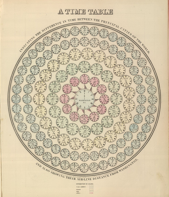
From "Mitchell’s New General Atlas" (1864)
By far the oldest chart to come across my desk this week, this time table was taken from Mitchell’s New General Atlas, 1864 “Containing Maps Of The Various Countries Of The World, Plans Of Cities, Etc. Embraced In Forty-Seven Quarto Maps, Forming A Series Of Seventy-Six Maps And Plans, Together With Valuable Statistical Tables.”

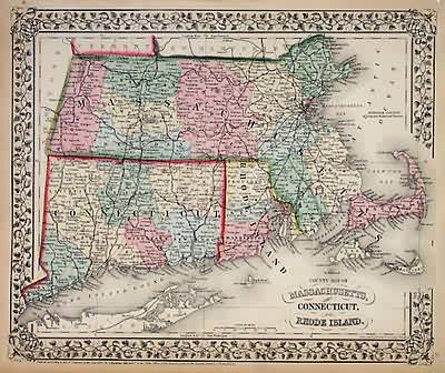
The best part about the Mitchell’s New General Atlas series, which ran from 1860 to 1893, is the consistency of its design and palette. The Atlases are full of gorgeous maps, plans and charts, including this wonderful map of my neck of the woods:
The changing face and economic growth of the United States during the 19th century created an excellent market for maps and atlases for businesses, government, schools, and homes. The Mitchell Company, headed by Samuel Augustus Mitchell, was one of the leading map publishers for most of this time.
You can flip through the 1861 version here.