Fancy Charts: Distribution of Slave Populations in the USA in 1861
Charts, CulturePublished: March 21, 2011
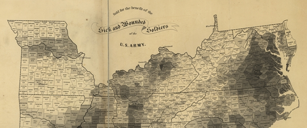
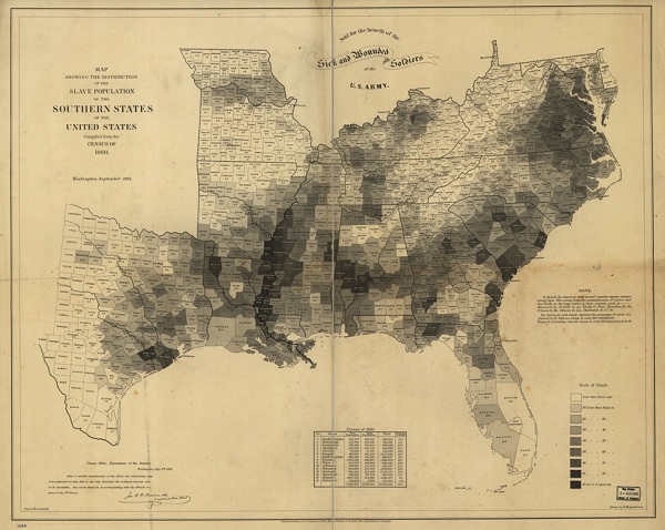
This map, showing “the distribution of the slave population of the southern states and the United States,” was created in September 1861 based on statistics from the eighth Census. Says the NOAA:
“President Lincoln frequently consulted this map in considering the relationship between emancipation and military strategy… Lincoln would look at the map and send his armies to free blacks in some of the highest density areas in order to destabilize Southern order. The Emancipation Proclamation became law on Jan. 1, 1863.”
For a closer look, click here.